| Membership | Price (+HST) |
|---|---|
| Single | $85/year |
| Single Plus | $120/year |
| Family | $130/year |
| Family Plus | $175/year |
| Contributing | $300/year |
| Supporting | $600/year |
| Sustaining | $1,000/year |
| Benefactor's Circle | $2,500/year |
| Director's Circle | $5,000/year |
| President's Circle | $10,000/year |
Trail Maps
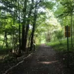
RBG’s nature sanctuaries stretch across Hamilton and Burlington and feature more than 27 km of nature trails with four main trailheads and two canoe launch sites. The trails traverse challenging landscapes and as such are classed as wilderness trails with most trails containing hill sections with steep grades.
Trail widths are about 1m with natural material surfaces. Grades at Rock Chapel and Princess Point accesses areas are relatively flat at 1% grade, while the Arboretum and Hendrie Valley Trails have maximum grades of 25%. Most trails have elevation changes of 20m. Trail cross slope angles do not exceed 5%. The Desjardins Trail accessed from Princess Point is a flat multiuser paved trail, managed by the City of Hamilton on RBGs behalf and is part of the Trans Canada Trail network.
Royal Botanical Gardens acknowledges the long history of First Nations and Métis People in the Province of Ontario, and pays respect to the Six Nations of the Grand River Territory and the Mississaugas of the Credit First Nation, the holder of the Treaty with the Crown for these lands. The land we steward is within the traditional territories of the Haudenosaunee, Anishinaabe, and Huron-Wendat Nations.
Before joining us, be sure to check out the Trail User Notes at rbg.ca/onthetrails for the lastest safety tips, and individual trail interruptions / closures.
Cootes Paradise Trails
Established in 1927 for its significance as a migratory bird stopover, Cootes Paradise is RBG’s largest and most diverse sanctuary at over 600 hectares. The area features a 320-hectare river-mouth marsh, 16 creeks and 25 kilometres of shoreline.
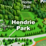
Hendrie Valley Trails
This 100-hectare sanctuary is centred on the Grindstone Creek Valley. The area features forested slopes with towering trees, a 60-hectare river-mouth marsh complex and four creeks.
Escarpment Property Trails
Niagara Escarpment World Biosphere Region is represented here by several properties forming a 110-hectare, three-kilometre ribbon along the Escarpment edge.
Hiking the trails is free, but maintaining them isn’t
Royal Botanical Gardens (RBG) is the largest botanical garden in Canada, a National Historic Site, and registered charitable organization with a mandate to bring together people, plants and nature.
On the Trails
Find hours, frequently asked questions, trail user notes, trail etiquette guidelines and more.
Conservation Projects
It is our mandate and challenge to protect these lands as an ecological legacy for future generations by balancing the needs of wildlife with more than 100,000 visitors who walk our trails each year.
Membership
Enjoy the trails all year long with an RBG Membership! Members receive a 1-year pass for free parking at all official RBG trail heads.

